Monday, June 5, 2023

Driving Time

 We set off Saturday morning winding our way through the Black Hills of South Dakota for the last time.  The steep winding roads may have been a work out for Georgie Girl, But the slow pace required allowed us to enjoy the serenity of the landscape. Our next stop was out of the way but the only destination on our plan for the next two days and would be a welcome respite.  Once out of the Black Hills we were back on the plains, at least Interstate 90 provided a smooth ride heading East to Chamberlain, SD.  The Not-so-well-known Monument is called "Dignity" of Earth and Sky. 

Dignity of Earth and Sky is a soaring sculpture of a native woman standing high on a bluff above the Missouri River.

Dignity honors the Native Nations of the Great Plains. The sculpture is located on a bluff overlooking the Missouri River at a Rest Area on I-90 near Chamberlain, South Dakota.

Her Star quilt is made of 128 diamonds in the colors of the water and sky that surround her.

Dignity is 50' tall, 32' wide, weighs 12 tons, and is made of hundreds of pieces of stainless steel.

To be fair to all of you, I had never heard of this.  Lynn was told about it by a friend and decided to add this to our itinerary. It does appear to be gaining in popularity, there was a consistent line of folks walking over to the sculpture while we were there and looks like a following on Facebook for it as well.

We headed back West on I-90 about 10 miles and then Due South.  From there on, The photo on the left is a good depiction of the next 2 days travel.  I have found a new definition of Monotony, and that photo says it all.  I guess these roads were constructed back before they realized how dangerous an unwavering straight road could be.  Staring at this scene for hours with nothing changing but the roar of the wind and road can put you to sleep better than a glass of warm milk and cookies.  We did however learn that below the seemingly endless blanket of grass, lies he Largest Sand Dunes in the USA  Over 20,000 Square Miles of it.  And further south, more of the same but instead of sand dunes, a vast Ocean floor now mostly sandstone still looking just like the picture above.  A few communities poking up from the landscape along the way, little more than remnants of a time long past.  One such community is working to remain on the landscape and provided us with a place to rest along the way.
Taylor, Nebraska is a community with a population of just 182 souls with almost half as many more "Villagers" both in town and a few miles outside of town to brighten a weary travelers heart.  We were driving along and noticed a couple of "Villagers" at the corner of a fence row in the middle of nowhere.  Lynn and I both smiled at each other thinking "what was that?"  A short time later we came across another couple, this time 2 boys with fishing poles.  As we approached the town of Taylor, they seemed to be there greeting us as we arrived.  It did brighten our spirits and the town had a small park just a block off the highway with RV spots available. I won't go into much more here other than to leave this link to The Villagers of Taylor Nebraska. We stayed the night, so glad for the break and ready to relax.  The next day we got going, knowing we would eventually venture past the endless blank landscape to find the old west historic town of Dodge City, Kansas. 

Having been to all of our planned destinations, Dodge city was just a place on the map that might provide more than an overnight stop.  After 2 days for nothing but a blank landscape and what seemed like driving forever, 2 days parked anywhere would have been good, and Dodge City looked like it would make for a nice stop.  We booked a spot at the Gunsmoke RV Park.  A cute little park, themed after the old tv series of the same name.  Full hook-ups available, a swimming pool, showers, laundry, and a smattering of trees.  We passed through a thunderstorm on our way in thankful for the free car wash removing most of the insect carcasses stuck to the windshield.  We promptly set up camp and got dinner started.  It's now day 2 and we've hardly ventured out of the RV.  Tomorrow we pack it all up and make our way back to Arkansas for a few weeks. 

Thanks for visiting, give us a call or drop by if it suits you.
Steve, Lynn, Toto, Bilbo, and Georgie Girl


Saturday, June 3, 2023

Monumentous

 I should have started this post yesterday.  Yesterday, was a bit more relaxed than we had originally planned.  The drive from Sundance, Wyoming to Spokane Creek Cabins and Campground outside of Keystone, South Dakota was just over 2 hours. Originally, our plan was to see Mount Rushmore and Crazy Horse along the way but since we were going to stay here for 2 days, we decided to just head to the campground and take it easy on day one.  Lynn had reserved a spot at the top of the campground which put us away from the majority of other campers and gave us a view from above it all.  No cares or worries, just relax and enjoy the evening for tomorrow will be a day of destination and discovery.  

We adjusted our plan today to make a circumferential loop from Mount Rushmore to Crazy Horse, through Custer State Park and back to the campground.  We left the campground and wound our way through the twisting roads leading back to Keystone, SD.  A mining settlement established in 1883, It wasn't incorporated as a town until 1972.  Today its a tourist hub,  everything you can imagine on the main drag from trinkets to mugs and coffee to......   OH, A place like this may not have a starbucks, but there must be some place that can make me a good Latte' right?  Bingo, Holy Terror Coffee was there to fulfil my caffeine desires.  I swept into the suicide lane, turned into the strip mall of shoppes, and skillfully backed my Georgie Girl into a parking space right across from the door.  Loaded up on a Latte', Blueberry Muffin, and a Giant Cinnamon Roll that was calling to me through the display case, Yum.

In a few minutes we were back on the road and just 5 minutes away from Mount Rushmore. I wish my mother was still here to give me the specifics, but my best guess is I was here about 50 years ago.  I had looked over the area on Google Maps and noticed there was a big difference in what the Mount Rushmore visitors area looked like compared to when I was last here.  Back then, it was little more than a 1600 sq. ft. building with an equally small observation deck looking towards the sculpture from such a distance that as a teen, left me sort of unimpressed.  

Today, the new visitor center can accommodate 2,000 visitors per day.  It features granite colonnades, an Entry Promenade paved in granite, a Parade of Flags followed by an amphitheater below the carvings.  The Parade of Flags features the flag of each U.S. state and territory, with a pillar showing the date that it entered the Union.  There is also an exhibit hall that displays information about how the granite sculptures of the presidents came to be.  Being able to get that much closer brought me a lot more respect for the work and scale of the monument than I had as a teen.  Not to diminish it in any way, I guess I was equally impressed by the work done to improve the visitors center facilities.  

On to our next stop, the Crazy Horse Memorial.  A mountain monument to Lakota warrior Crazy Horse, riding a horse and pointing to his tribal land.  It has been under construction since 1948.  Considered the world's largest mountain carving.  When finished, it will be 641 feet long and 563 feet tall. The head of Crazy Horse alone is 87 feet tall, 27 feet taller than the president's heads of Mount Rushmore.  

This is a multi-generational carving, the original sculptor's grandsons are still at work on it.  It seems like little has been done since I was last here but that's not true.  It's only the sculpture itself that has changed so little.  It is the millions of tons of granite that have been removed and still to be removed before the sculpture can be revealed from within the mountain.  If you look closely at the picture, you can see the equipment on top of what will eventually be his arm. 

The hole under his arm is little more than a working tunnel.  You could drive a semi through it right now.  When it's finished, the opening will be 150 feet from below his arm to the horse's back. You can see his finger is nearly finished now and the hand is beginning to take shape.  We've already decided to come back in 5 to 10 years to see its progress.  A scale mockup of the finished statue is on display at the visitors center.  They are estimating the hand, arm, shoulder, hairline, and the top of the horse's head will be finished by 2037.  

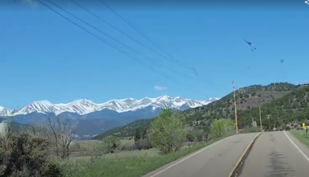
From here we were ready to complete the loop back to the campground.  This would take us through Custer State Park.  The Park looked well kept and there were several camping areas, lakes, playgrounds and everything you might expect from a State Park.  In fact it looked so nice we decided we would rather set up camp in the State Park next time we come back to the area.  We stopped near a picnic area to let the boys out for a short break.  In all our coming and going of the day, Toto and Bilbo were stuck with either one of us most of the time while we explored the visitors centers.  We double checked the route back to the campsite to be sure it wasn't going to lead us to one of the tunnels Georgie Girl couldn't fit in, It was safe...

Hwy 16A was designed as a Scenic Route only, full of hairpin turns, corkscrews, and 1 lane tunnels less than 10'9" x 10'9".  Just after the turn back onto US 16A was a sign denoting "Bison Are Dangerous, Do Not Approach."  and we thought "maybe we'll get to see some."  It was definitely a scenic drive, and as we were in no hurry, I set the Cruise control at 25 mph and pulled to the side whenever there was a car or 2 tagging behind.  Lynn wanted to make a record of that, and I proceeded to do it a few more times along the way.  As luck would have it, about 3 miles short of the campground, Lynn spotted a Bison grazing on the hill about a hundred yards from the road.  I was able to catch a glimpse of him before rounding the next 15 mph curve and the hills and trees broke any chance of seeing him again.  Shortly, we were leaving the State Park boundary and approaching the campground.  Dissatisfied with just a glimpse, I asked Lynn if she would mind if we went back to see if we could get a photo.  She reluctantly agreed and I found a spot just outside the campground big enough for Georgie Girl to make a U-turn.

We drove back to the general area where we spotted the Bison and I was searching for any pull-offs nearby that would allow me to stop and get out for a shot.  Luckily there was a pull off just ahead on the left with an SUV parked on it but plenty of room left for me to get in.  The SUV had stopped to observe the Bison we saw and now they were just 50-60 feet from the road.  I parked and got up with my cell phone headed for the door only to see that one of the bison had actually walked between the SUV and Georgie Girl and was alongside my drivers window.  Now there were two of them, One on each side of the road flanking us.  Both Males and both between about 3-4000 lbs. each.  I was looking for a photo op, and got a good one.  We got a few more shots and they wandered off a little further.  Now I had to continue on until I could find another spot wide enough to turn back around and head back to camp.  There wasn't one until we got back to where US 16A turned off.  We got turned around and headed back but luck wa still in my favor and the Bison were now headed up the road coming towards us.

So we stopped to let them pass... and finished our trip content that our plans were fulfilled.

We got back into our campsite and hooked up utilities.  Toto and Bilbo were restless now and there was a trailhead right beside our campsite so I decided to take them for a hike to give them some good exercise and I could use a bit myself.  OMG, this trail went right up the side of the mountain to the top where there was an American Flag on a flagpole mounted to the granite Boulder at its peak.
I had to stop twice along the ascent to rest and catch my breath.  Toto and Bilbo were pulling me up the hill for a good bit but they slowed down to a casual walk before we made it to the top.  Walking back down to camp was a relief, and the boys made little time of devouring their dinner and crashing out on the bed.  A nice quiet time for me to get this blog back up to date.  The next two days will be travel days heading East to another not-so-famous monument, then southwest to the Old West town of Dodge City, Kansas.  Thanks for dropping by, please leave a comment to let us know you came.
I'd like to get your thoughts about the blog to help me decide how best to proceed.  Any and all suggestions will be considered.  Bye for now
Steve, Lynn, Toto, Bilbo, and Georgie Girl :-)


Wednesday, May 31, 2023

...This means something...

 Today was a Destination travel day.  I prepared the night before by packing up the fence, outdoor carpets, and folding chairs.  That shortened the departure list by about a half hour.  We awoke at 6:30 this morning, Got cleaned up and dressed, Then...:

  • Let the dogs out for morning relief
  • Make and fold up the bed
  • Empty all trash cans
  • Retract the Slide out
  • Disconnect Electrical and store Main Power Cable
  • Check and Lock all exterior Storage bays***
  • Start Engine
  • Raise Hydraulic Leveling jacks
  • Retract Awning and stairs
  • Lock Door
  • Drive to Dump Station and Empty Holding Tanks
  • Dispose of Trash
And we are ready to leave.

Not noted above, was coffee and breakfast.  We discovered preparing our travel day that Starbucks and Chick-fil-A are next door to each other on our route from the park to the Interstate.  How Convenient!  
Also Noted above is *** on the storage bays.  I missed one of the bays and we heard a bump when I stopped at a stop light.  We realized what it was when we got out to get coffee and breakfast. Oops!
It's those little things that reinforce your self-confidence.  I won't make that mistake again, trial and error learning at its best.  15 minutes later and we are back on the road.  Interstate 25 took us northward into the High Plains and Wyoming.  A stark reminder out my driver side window of the Rocky Mountain range slowly getting further away.  I was reminded of a song later as we got into Wyoming, "Home on the Range."  We started seeing small herds of wild antelope and after cresting a hill somewhere in the middle of nowhere a herd of Buffalo numbering at least a hundred.  The High Plains are evidently called that for a reason.  At Boyd Lake State Park, The elevation was at 4960 feet, Across the High Plains we were up to 6380 feet that I noticed on my Garmin at one point but gradually we descended to a comfortable 4700 feet where we are now parked at the Mountain View RV Park in Sundance, Wyoming.

I'm getting ahead of myself though.  This was after all, a Destination Travel Day.  I'm sure most of you have expected to see some pictures by now which is usually the case, but I really wanted to keep the anticipation going a little while longer.  We did make a stop in Cheyenne, Wyoming.  It allowed all of us to take a break, fill up the gas tank, and give the boys another relief stop.  

Georgie Girl has an 80 Gallon Fuel tank, Logically it makes sense to fill up at half a tank.  Reason One is; The Maximum Card Authorization at the pump is $175.00 so a half tank shouldn't reach that limit.  Reason two is; you never know just how far it is to the next Open Fuel Station.  At 8 to 10 miles per gallon, before you know it, that second half of the tank is always dwindling away faster than you might like.  And Fuel Prices here are about 50 cents higher per gal. than at home. 

Back on track, we continued on our way making good time.  The roads here are OK, not too many potholes, I really expect more in the northern states where the winter freeze can do its worst to a road surface.  After a time, the High Plains became more of rolling hills and without realizing it, we all of the sudden noticed there were trees on the hillsides again.  Our Destination was now 32 miles distant as we got off the interstate and turned onto US Hwy 14 East.  Still, no visual clues aside from the odd Sign to let us know we were headed in the right direction.  Speaking of which, We stopped at a rest area (on the left) and had lunch.  When we headed back out, I made a right and My wife kindly informed me about a mile down the road I was going back to Colorado.  Oops #2 for today...

We had planned this entire trip months ago.  Lynn had never been to Mount Rushmore, and with the Crazy Horse Statue nearby it was a 2-for-1 and we found a beautiful campground in the mountains not far from both.  Oh, I'm getting ahead of myself again...  I recall there was another National Monument in the general vicinity but I wasn't sure just how near.  Lynn of course did a little research and we added this little stop along the way. President Theodore Roosevelt proclaimed Devils Tower as the first national monument on September 24, 1906.  The Devils Tower National Monument gained notoriety in 1977 as a central figure in the now classic Steven Spielberg Sci-fi Production of "Close Encounters of the Third Kind"  The topography surrounding the monument left us in anticipation knowing it was ever closer but not revealing itself till we were about 7 miles away, then disappearing again as the road dipped back into the valleys.

At last the monument came into view and I took a photo a few miles away from the park. 
We had planned to stay here for an hour or two depending on how much was on display at the visitors center.  The road from the gate entrance climbs and winds around the tower ending at a parking lot near the base of the main column where the Visitors Center is.  A footpath continues on beyond that with a registration desk for those bold enough to attempt climbing the face.  Lynn and I are old enough to enjoy the view and not suffer the climb up the footpath.  We each spent some time in the visitors center observing the few educational displays and perusing the gift shop while the other was entertaining Toto and Bilbo outside.  While Lynn was inside, I noticed a couple of telescopes mounted to the sidewalk and a few people peering through and commenting about a climber.  

I got my phone out and zoomed in on the near vertical face to find a climber about 2/3s of the way up.  After observing the screen for a few minutes, it was clear this climber had met his match and was frozen in place, probably contemplating his life choices and wondering how to survive as I snapped the shot.  I watched him for another 3 or 4 minutes and he eventually began rappelling back down the face to a ledge about 50 meters below.  I would have loved to make a climb like that 30 years ago but, I prefer free climbing and nowadays that's completely out of the question.

I had to get one last shot before leaving and found this spot where I could frame it between two trees.  Its hard to imagine the scale of this thing until you have a reference like the climber in the previous shot.  If you compare that shot to this one and identify the spot where the climber was you'll have a better idea of the scale here.

We made our way back to the RV and descended back down towards the park entrance.  As you get to the more level ground towards the bottom there are a few pull offs on the side of the road.  to my wife's delight, this was beside a field full of Prairie dogs, there were hundreds of little burrows dotted around the meadow with the prairie dogs standing guard by the entrances.  

We made our way out of the park and headed southeast to the town of Sundance, Wyoming.  Here we'll just stay the night and head back out again in the morning for destinations 2 & 3 in the Black Hills National Forest of South Dakota.  I haven't been to Mount Rushmore in more than 40 years and from what I spied on Google Maps, It looks like they have done a lot to develop the area better for tourism in that time.  We're also slated to see the Crazy Horse Statue nearby although we have to manage logistics in the morning since Georgie Girl is 12 feet 2 inches high and there are several Tunnels she just wont fit into.  I'll let you know how we did in the next entry.  

Till then, I'll have a nice shower and a warm bed to relax in while Toto, Bilbo, Lynn and I stretch out and watch "Close Encounters of the Third Kind" likely drifting off to sleep about an hour in.  


Tuesday, May 30, 2023

Boyd Lake State Park

We arrived early enough to make a few stops for supplies and groceries before entering the park.  My wife Lynn chose this place as a mid-point along our route and I was a little reluctant at the idea of camping in the middle of a city but the ratings and reviews made it a viable option.  I got the RV set and leveled and proceeded to prepare the campsite.  

Having the dogs, Toto and Bilbo, means making the campsite ready for them as well.  We found a 24" x 24" 8 panel puppy fence and bought 4 of them.  This makes it easy to just let them out in the morning without having to put on their harnesses and leashes and gives them a little more freedom to enjoy the vacation without being tied down. It usually takes me about 20 minutes to get it all set up but like so many things required of a camper, it's just part of the process.

I awoke this morning bright and early at 6:30, Sunrise was at 5:30 so when I stepped outside with the boys the sun was already making a pleasant impact on the 55 degree air.  I was also reminded of how spoiled I am as I watched 4 or 5 nearby campers breaking down preparing to leave.  Tent camping is so much more work than I must commit to now with the RV.  I watched the family across from us spend 90 minutes carefully breaking down their camp and putting it all away in boxes and bags arranging it all in the back of their SUV.

Boyd Lake State Park is a water-sports haven in northern Colorado.  The park lies at the westernmost edge of the plains at the foot of snow-capped Long's Peak and the mountains of the Continental Divide providing boating, fishing, camping, picnicking, swimming​, hiking, biking, and hunting.  In the campground you hardly notice you're in the middle of a sprawling city aside from the occasional sound of a Jet airplane taking off from the nearby regional airport or police/ambulance sirens in the distance.  There were only electrical hookups but a water spigot and dump station were available nearby.  The campground area was busy of course being Memorial Day but It didn't take long this morning for the majority of campers to disperse.  Several playgrounds located across the camping areas to keep children busy, with slides, swings, and I even noticed a well planned Horseshoe pitch.  By 9:30, we were almost alone on this end of the campground as I noticed the camp host was moving from site to site cleaning and raking each one in anticipation of the next campers to arrive.  The park appeared well maintained and to see it in action gave an even better appreciation for those making it so.  Nothing can ruin a campsite more than finding all sorts of debris left by the previous occupants.  Kind of like finding the sheets haven't been changed when you check into a hotel room.
The view to the west is a reminder of the astounding beauty we passed through just yesterday.  As we were making our way north from Denver with the mountains were on our left, Lynn said "Look, It's the Coors Can" and I think she's right, It must have been the inspiration for the background on the Coors beer can.  Being on the high plains almost felt like an anti-climax after spending a week around the Gunnison range.  And the rest of our journey is planned out in 2 day stops from one location to the next as we meander our way home.  I had thought we were committing ourselves a little more than we should at first but being out here for the past week makes me feel like we might look at staying a little longer at each location.  The afterthought of course is that I hate getting bored, and staying 3 days somewhere with nothing to do is not on my bucket list.  I've already found I enjoy sitting here writing the blog and it keeps my mind busy enough to pass the day, but it's NOT why I'm here.  

On a personal note, I'm going to become a Great Grandfather in the next 3 months, and I just found out another of my granddaughters is now engaged.  I'm amazed how fast life progresses the older I get.


Memorial Day Travels

Memorial Day was a day of travel for us.

Overall about 6 hours of driving, climbing up over 10,000 feet across the Continental Divide and back down below the 5,000 foot elevation.  Breathing easy again, yeah.  

Looking at the map you might wonder why we took a westerly roundabout route, It actually added a half hour to the trip according to google so I'll briefly explain.  The recommended route would have been more direct but it would also have included traversing the steep and winding US Hwy 50 across Monarch Pass.  Monarch Pass is 11,312 feet above sea level and a very scenic drive, in a car...   

With a 6 - 7% grade for almost 10 miles and figuring in the tight winding curves, it was just more of a workout than I wanted to deal with and I didn't want to put Georgie Girl through that kind of a work out either.  Taking Interstate 70 meant that we'd save over 1,000 feet of elevation and Georgie Girl would be able to keep up with traffic, and so she did!

It was a beautiful drive on I-70 passing through the Vail and Breckenridge ski areas, there wasn't enough snow for the skiers but the mountains were still draped in white.  On a side note, I noticed there was a concrete paved sidewalk / bike path following alongside the interstate most of the way.  If you like cycling and have a fit body, it looks like fun.  To be fair, most of the bikes I saw were all electric assist bikes.  

We're staying at Boyd Lake State Park outside of Loveland, Colorado.  This is just a layover on the road to Wyoming.  We'll be here for two days, just because I hate pulling into a place and slipping out the next morning.  And after the drive I had today, I'd like a day of rest before starting the next run.  

I hope you've all had a nice Memorial Day weekend, I know we did.  I'll write again from our next destination.  Have you guessed it yet?  🤔

Sunday, May 28, 2023

A Little Solitude

 Imagine waking up to this view every morning...

We've been spending the week here with family not far from Crawford, Colorado.  The area is quite picturesque in every direction but there is more to take in than just the raw natural beauty.  20 or 30 years ago I would have spent much of my time hiking and free-climbing every opportunity open to me.  These days, I still haven't acclimated to the altitude well enough to consider much more than a gentle walking trail.  We did take a short hike out to the Rim of the Black Canyon (on the previous post) but life in any geographic location needs a little spice to thrive and this area is no exception.

Interestingly, we spent Saturday exploring the area and stopped for a wine tasting at the Azura Cellars and

Gallery in Paonia, CO.  What a delightful treat, I never expected a vineyard here, and we saw at least 3 on our way to Azura.  I've never much liked wines, But Lynn is quite fond of wine and at Azura I found their Yacht Club Red not too sweet and not too dry quite pleasing even to my uneducated palette.  Lynn purchased a bottle of Malbec and we enjoyed a glass sitting out on the patio with a charcuterie board.  

A short drive back down to the valley we stopped for an early evening meal at a place called Big B's Delicious Orchards where they had live music, Hot Food, a campground, and a country store with local flavors.  There was an absolutely eclectic crowd of people there all enjoying the music and what I can only describe as square dancing although the sign out front indicated it was Contra Dancing.  I wasn't too keen on the idea of taking pictures here but if you click the link above and explore their website you'll get a good idea of the vibe here.  I think this would be a fun place for anyone to drop in or even camp/stay a night or two if you're passing through the area.

One hard to miss geographical landmark in the area is Needle Rock.  A volcanic plug 7874 feet above sea level exposing about 870 feet of igneous rock a thousand feet above the adjacent Smith Fork. There is a hiking trail up the northeast side and I imagine this would be one to put on the list for any rock climbers.

On a side note, as we passed back through Crawford, CO on the way back to the RV, a noted building in disrepair known as Mad Dog Ranch Fountain Cafe.  The establishment had been owned and operated by none other than Joe Cocker.  The "Mad Dog Ranch" was located near to the Needle Rock Monument and as it happens, Joe Cocker is buried at Garden of Memories cemetery about a block away from his old cafe.  

We'll be headed northeasterly back across the Rockies with a 2 day break in Loveland, CO on Monday.

Enjoy the Memorial Day Weekend, I'll update again time permitting...  Thanks for stopping in.  

Saturday, May 27, 2023

Rocky Mountain High

Traveling in an RV has a long list of benefits as long as you're prepared for the responsibilities and effort required to make it go as smoothly as you wish.  As an avid tent camper in my 20s and 30s, Setting up or tearing down a campsite was always part of the experience.  The same is true in an RV, albeit a little less strenuous on this 60s body thank you.  We made most of our preparations the night before to make an early go of it.  

Our first stop would take us back down to the town of Trinidad, where I could visit the last Starbucks available to me for the next 5 days or so.  We can make coffee anytime but I do have an affinity for Latte's and cannot manage that in the RV just yet.  Doubling back, we followed the Purgatoire River to the small community of Stonewall, Colorado.  I only mention it because this place holds many fond childhood memories for me as our family took several vacations in Colorado stopping here along the way. 

Colorado State Highway 12 is part of the Highway of Legends Scenic Byway.  Stonewall Gap is a gap formed by the Middle Fork of the Purgatoire River through the Stonewall Ridge. The highway leads west from Trinidad to the gap at Stonewall, then north over Cucharas Pass in the Sangre de Cristo Mountains to the town of La Veta, CO.

One of our concerns along the way was the elevation and lack of oxygen.  This played a part in our decision to stay for 2 days at Trinidad Lake.  Getting acclimated to the thinner air takes time and Cucharas Pass is at an elevation of 9995 feet above sea level.  That said, The drive was breathtaking in more ways than one.  
Rounding a corner to see the snow covered peaks of the Rocky Mountains beyond is always a high point.  
Handheld canisters of oxygen are available for those with any concerns at high altitudes and we had them at hand just in case.  We were able to cross over Cucharas Pass and down into La Veta without incident.  Once through La Veta, We were back on the rolling plains headed west towards the Great Sand Dunes National Park.  This is sort of a spectacle and seems out of place among the Rockies.  At first glance from a distance it just looks like a slightly lighter color of rock at the foot of the mountains, But looks can be deceiving and approaching the dunes it becomes clear this is so much more.  The Dunes are more like Mountains in their own rite.  There is a river that flows around the dunes several meters wide and what appears to be only a few inches deep.  In reality, the river is several meters deep as well and simply hidden by the sand peeking above the surface during the wetter seasons and disappearing from view when the levels are lower.

Great Sand Dunes National Park is busy with tourists 
especially in the summer months and the RV park
there is often booked up months in advance.  We did not intend to stay but only to visit and explore the visitors center.  Unfortunately the Visitors Center was undergoing renovations so our stop was cut short and we headed back out across the plains to make our way northwest towards Gunnison, CO.

Along Colorado Hwy 114 onward, the geography draws you into a maze of beauty as it wanders the steep canyon bottom carved out by the Cochetopa Creek.  There was so much to take in and hardly a chance to get a shot of this drive that would do it any level of justice.  We did stop to take a break along the way just to be able to relax and soak in the moment. 

There were several pull offs along the way with picnic tables where the canyon bottom provided enough room between the road and the creek.  From what I understand now, we could have parked here overnight.  As tempting as it was, this was just to be a short break in our drive.  Georgie Girl gently meandered along coasting downhill through the canyon until it began to open up and meet with US Hwy 50 which would take us into Gunnison, CO.  We stopped to pick up a few supplies and reacquaint ourselves with the map and remaining distance to our destination just outside of Crawford, Colorado.  

The first several miles were uneventful and we were aware of road closures and delays ahead on US Hwy 50 and a more direct route would enable us to turn off short of the road work and follow the Gunnison River along Colorado Hwy 92 starting at the Blue Mesa Lake.  I have a hard time describing what follows as I was completely unprepared for both the road and its geography.  This was both intense and dramatic, with curvy twisting 2-lane road following along what I can only describe as a deep gorge cut out by the Gunnison River.  I would find out later, further north this is the Black Canyon of the Gunnison.  Lynn was firmly gripping her armrests the entire time while I was in awe of what looked like a bottomless crevasse.  There were many times I was unable to see the bottom and Lynn would clearly point out I need not try to describe it to her but just keep my eyes on the road,  Good advice as this stretch was fraught with many 15 Mph turnbacks warning to keep in your lane.  After what seemed like over an hour of this, The highway finally broke away from the canyon rim and settled into a much gentler landscape finally reaching our next stop near Crawford, CO.  Home to a few close relatives who had space for us to hook up and get Georgie Girl Leveled and settled in for a nice visit.   
Black Canyon of the Gunnison (North Rim)

As impossible as it was to take any pictures along the drive up Hwy 92, We did drive up to the north rim of the Black Canyon of the Gunnison and took a short hike out to a vantage point on the rim.  I wish these pictures could give you a sense of the grandeur we experienced.  

NOTE:  All of the photos can be clicked on to enjoy full screen on whatever display you're viewing.

We'll be staying here for 5 days before we head northeast across the Rockies for a 2 day stay in Loveland Colorado.  There's So much more to come, and I look forward to your comments and suggestions.  
(I really do)

Return to Petit Jean

 It has been a rainy drizzly month with a few dry days in between storm systems.  June started off dry and warmer and a few days ago we star...